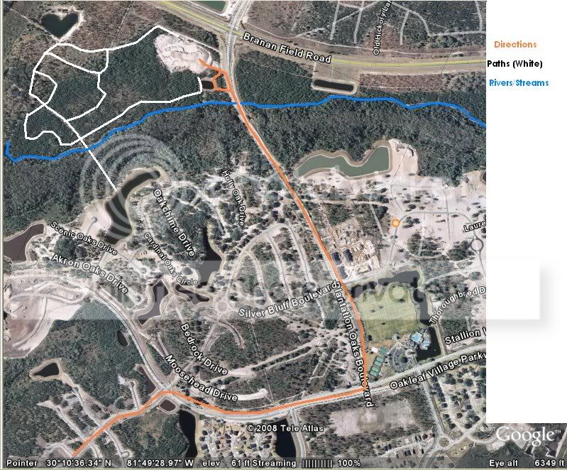
this is a map to where we like to ride.
it's nicknamed the canyon because it use to be a hill, about 40ft above regular ground there.
then it got dug out for clay and dirt. now, about 1/3 of it is left and has crevises(sp) that can span from a few feet to over 10 in depth, some spots are ridea-able to the top.
but most is a straight drop to the ground, 3 stories below.
in from ranges from one rough spot that becomes mud after a rain, the rest is either soft sand , grass or grassless plain.
behind that are trail around the perimeter.
very woodsy and wet. just a small 10' wide road with ditches on each side.
this leads to an intersection which either leads around further or to a small stream.
the white on the maps shows the woodsy trails and the orange is how to get there.
I'll try to get some pictures of it on here.
the altitude is over a mile up, so you can't really tell what anything is.
I should have some from at least a cell phone or something pretty soon.



 Reply
Reply